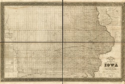
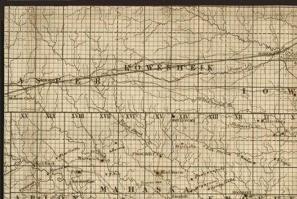
Map: 1850 Sectional of the state of Iowa, compiled from the United States surveys also exhibiting the internal improvements, distances between towns & villages, lines of projected rail roads &c. &c.;
[Product Information]
- Description: 1850 map Sectional map of the state of Iowa, compiled from the United States surveys also exhibiting the internal improvements, distances between towns & villages, lines of projected rail roads &c. &c.; drawn and published by Guy H. Carleton, Dep. Sur. U.S. Detailed township and county map showing drainage, cities and towns, roads, and railroads.
- Map Size: 16 inches x 24 inches | Ready To Frame | Archival Quality Reproduction on Fine Art Canvas
- Map Subjects: Iowa |