World Wall Map - with flags: 33.1 (W) X 23.4 (H) inches - Laminated
Product Description
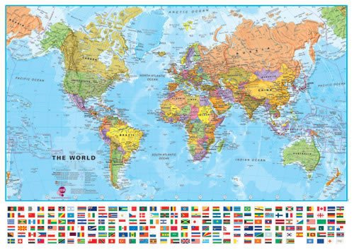
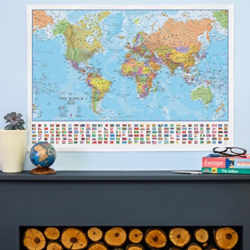
Maps International's large sized world political wall map is a fantastically produced high quality map. Our political world wall map comes with a panel of country flags along the base of the map.
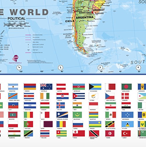
Map Details: Perfect for helping children learn about the world and countries in the news.Map details: Our large politically colored world wall map features every country in a different color, with country boundaries shown clearly. All major towns and cities are highlighted on our world wall map and capital cities are clearly shown. The map contains hill and sea shading bringing the map to life. The panel of flags along the base of the map and population facts and figures makes this map really interactive. The map contains nearly 200 flags including the Olympic flag, Red Cross flag and European Union flag, as well as all the country flags. One of our most popular world maps; educational and sensational looking! Perfect for a family room or child's bedroom.
Laminated: Your wall map will be finished with an encapsulation process. Encapsulation means that the maps are heat sealed between two sheets of industrial quality film. Please note that the edges of this map are not sealed.
Size: 33.1 x 23.4 inches
Packaging: Comes rolled in a tube.
Feature
Quality educational world map with panel of flags