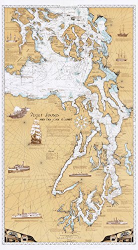
Sobay Map L001 - Puget Sound & San Juan Islands Chart - 30x54 Wall Map - Paper or Laminated (Vinyl)[Product Information]- Enter your model numberto make sure this fits.
- Choose Material Type 'Paper' for paper map, and 'Vinyl' for laminated map
- Our best seller! Based on marine navigational charts of the Pacific NW Coast. Includes historical notes and nautical points of interest on the Salish Sea.
- Made in USA, by artist Richard O. Malin of The Sobay Company, Olympia, WA
- Printed on heavy (70lb) paper, laminated maps have a durable 3 mil heat-laminated vinyl coating with matte finish
- Size: 30 X 54 inches, scale approximately 1 inch = 2.25 nautical miles, shipped rolled in Kraft shipping tube