Studio : C-MAP Publisher : C-MAP Binding : Misc. Product Description
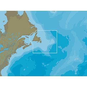
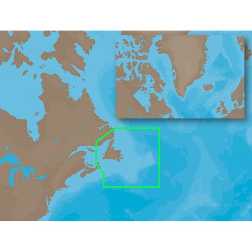
NT NA-C204 Newfoundland The Grand Banks - C-Card FormatCOVERAGE AREA:Newfoundland The Grand BanksCARD FORMAT:C-CardC-MAP NT cartography helped launch a digital charting revolution years ago, and it is still as useful and reliable as ever. For fishermen, sailors and cruisers who continue to depend on C-MAP NT , we provide updates twice annually to ensure that navigators benefit from all the latest Coast Guard Notice to Mariner (NTM) changes and other important chart data updates.Features:Full Featured Vector Charts C-MAP NT provides boaters with the accurate, up-to-date vector chart detail including Depth Areas and Contours, Spot Soundings, NavAids, Light Sectors, Wrecks/Obstructions, Small Craft Facilities and more.Harbor Approach Details The detail and information available with C-MAP NT charts lets boaters approach any harbor and inlet with confidence - the perfect conclusion to a long voyage, sailing adventure or exciting day of bluewater fishing.Tides C-MAP NT Tides feature presents the time, water level and direction of tides with Tide Level graphs. This information is vital for navigation and fishing.C-Marina Port Database C-Marina Port database and detailed marina charts in C-MAP NT provides useful, categorized information for cruisers, fishermen and sailors - including Port Layout and Facilities, Operating Hours, Accessibility, pho
0
|