Studio : Waterproof Charts Publisher : Waterproof Charts Binding : Misc. Product Description
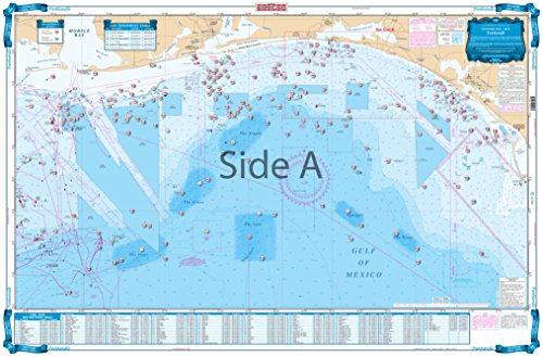
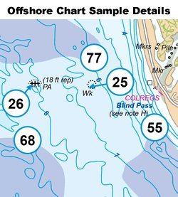
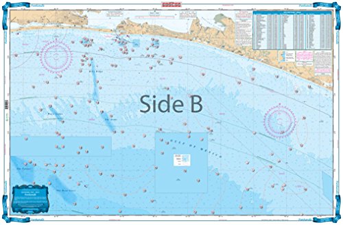
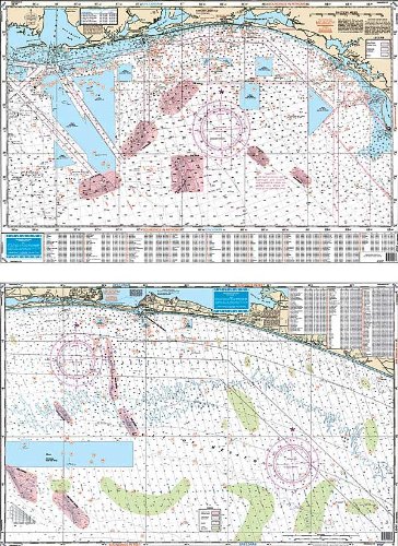
90F PANHANDLE FISH/DIVE Offshore Coverage from Cape San Blas west to Dauphin Island, Alabama and south to 29 degrees north latitude. (77 miles south of Destin). Features enhanced bathymetric contour lines in famous billfish areas; The Nipple, The Spur, The Steps, The Elbow, Desoto Canyon and others with GPS/Loran waypoints. The reverse side covers the coastal area from 20 miles east to 12 miles west of Destin and up to 22 miles offshore (200' depth) and features enhanced contours, numerous marked fishing areas and large areas of coral bottoms for Fishing and Diving. A total of 265 plotted and indexed GPS/Loran waypoints for reefs and wrecks, coral areas, ledges, artificial reefs, fishing and diving locations. Information from NOAA Charts; 11360 11368.25 x 38
0
|