Studio : Waterproof Charts Publisher : Waterproof Charts Binding : Misc. Product Description
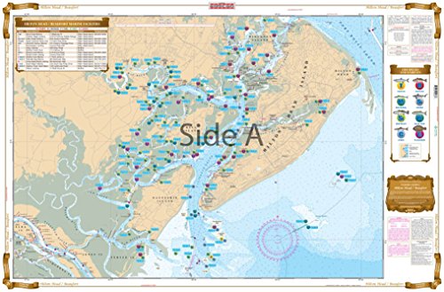
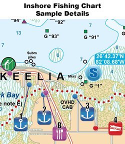
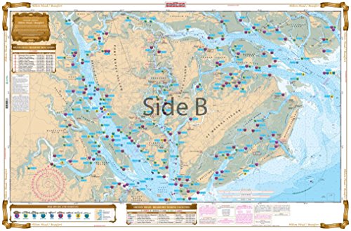
omplete Inshore coverage from Coosaw River to Hilton Head and Daufuskie Island. Detail of all backwater creeks and flats. This Special chart details all of the Oyster Rakes along with Mud Flats showing specific areas for the species caught in the area: Cobia, Redfish ,Trout, Mackerel, Flounder, Sharks, and Tarpon. Complete list of all of the area Boat Ramps with GPS Coordinates for use on your car's GPS. Information from 4 NOAA Charts: 11512, 11513, 11516, and 11517. If you are planning on FISHING in the Hilton Head / Beaufort area, you will need this chart.
0
|